

Description
Skitourenguru is a web-based tool to support the selection and planning of ski routes with respect to avalanche danger and other criteria. Interested students should not only have excellent programming skills but also be passionate about winter sports. Students will collaborate with the founder of skitourenguru in the course of their project.
Tasks
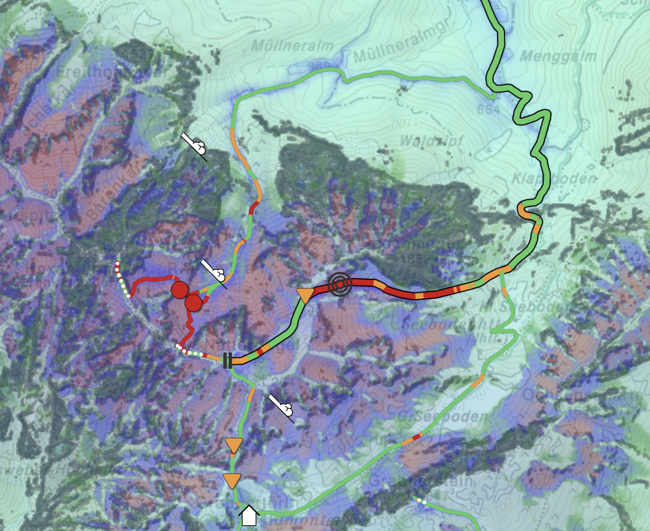
When selecting a route for closer inspection, skitourenguru color-codes segments of the selected route according to the computed avalanche risk and also shows additional icons, such as key danger points or past avalanche events. Currently, this information is shown on a 2D map. This work should visualize the selected route and its associated risk information in 3D. The objectives are performance, readability of route and terrain information on the 3D visualization, as well as usability (intuitive navigation, getting details on demand etc.). Depending on the type of work and the user interest, the strengths and limitations of 3D vs. 2D route representations should also be compared in a small user study.
Requirements
- Strong interest in (web-based) visualization and rendering
- Very good programming skills
- Experience with graphics programming (OpenGL, Vulkan, ...) is a big advantage
- Experience with web technologies (WebGL, WebGPU, ...) is also advantagaeous
- A good feeling for creating appealing graphics is a plus
- Being excited about mountaineering is definitely also a plus
- Experience with skitourenguru from a user perspective is a definitive advantage.
Environment
The implementation could use the weBIGeo framework or other 3D map rendering tools like MapLibre or Cesium.