

Description
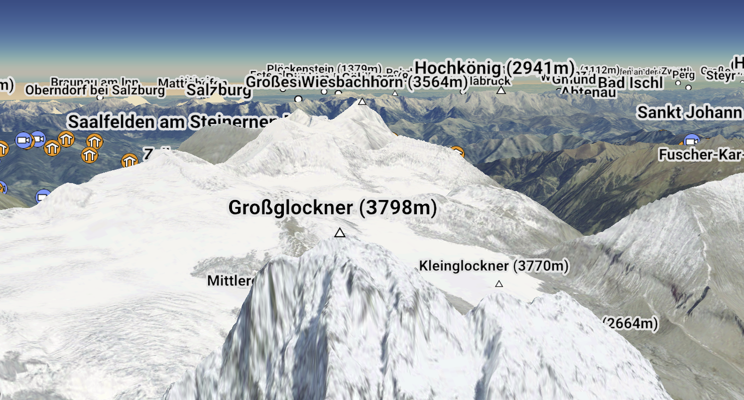
With increasingly detailed digital elevation models (DEMs), it is possible to render 3D terrain with very high resolution. In our weBIGeo project, we explored real-time 3D visualization of big geographic data on the web using the web graphics API WebGPU. 3D geographic visualization can only work effectively when users can orient themselves. Labels are therefore essential. We have the technical foundation to load vector tiles and render text labels for our WebGL implementation.
Tasks
In this project, this functionality shall be adapted to WebGPU and potentially extended to improve the view-dependent visibility of labels. Depending on the project type, different levels of labels could be combined (e.g., mountain peaks and regions), and the results should be thoroughly evaluated.
Requirements
- Strong interest in (web-based) visualization and rendering
- Very good programming skills
- Experience with graphics programming (OpenGL, Vulkan, ...) is a big advantage
- Experience with web technologies (WebGPU, WebAssembly, ...) is also advantagaeous
- A good feeling for creating appealing graphics is a plus
- Being excited about mountaineering is definitely also a plus
Environment
The weBIGeo project is based on C++ with Emscripten, WebAssembly, Qt, and ImGui. The concept and implementation is described in more detail in this preprint. The code can be found on GitHub. A first demo version is also online (a current version of Chrome is required).