Speaker: Lucas Dworschak
Abstract
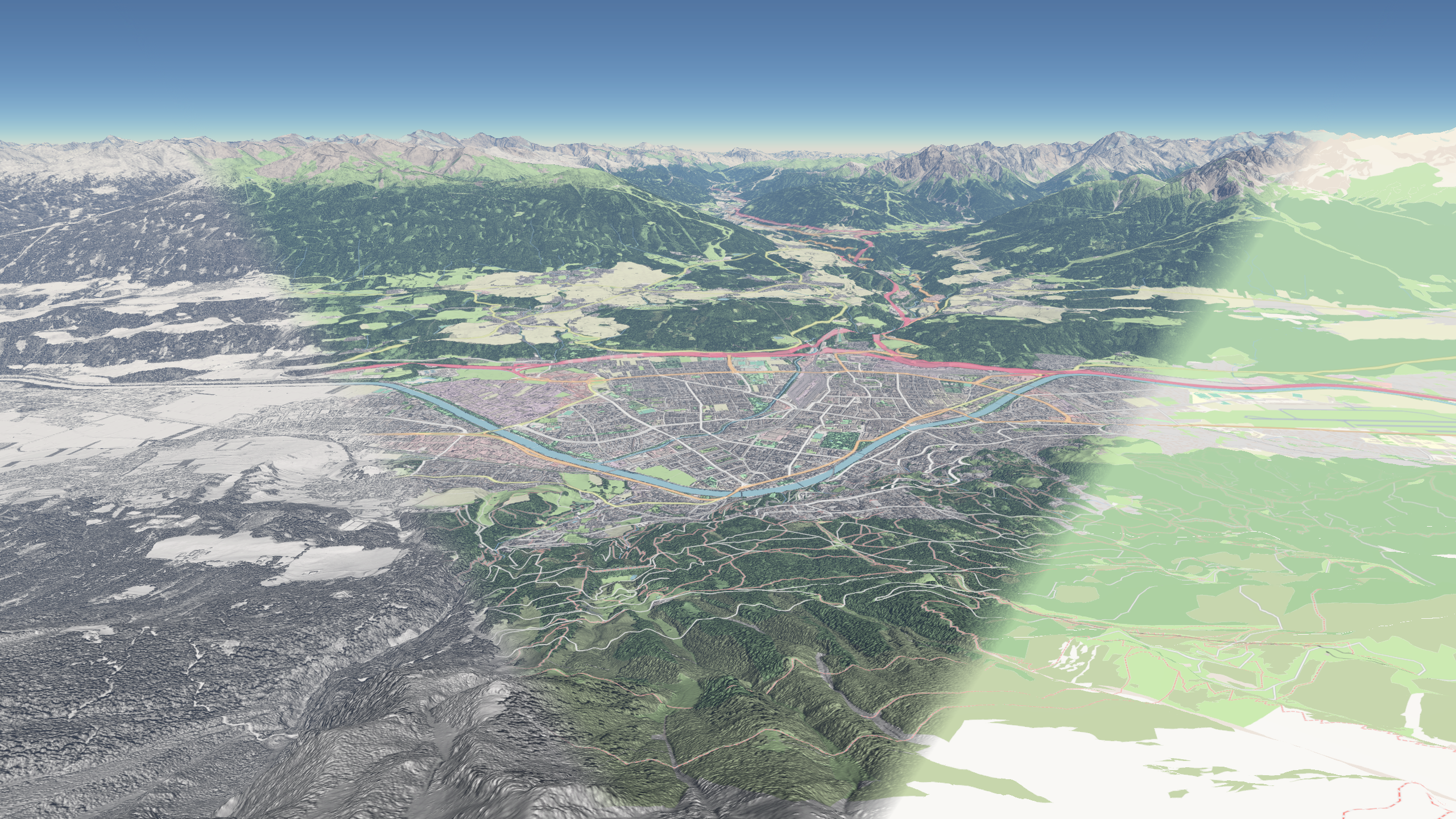
Visualizing geospatial data is an important part of interpreting interactive maps. The visualization must be concise, accurate, and user interactions should be processed in a timely manner. Two dimensional maps can use a hierarchical tiled data structure like vector tiles to achieve these requirements. Using this data structure allows the map to process only geospatial data that are relevant to the current viewport. Furthermore, it is possible to provide a level of detail that is currently relevant to the user. However, when the map uses three dimensional terrain, visualizing vector tiles introduces additional challenges that need special considerations. In this thesis, we provide a general solution that renders tile-based vector data accurately and in real time and addresses the problems that arise with the use of the third dimension. The work describes the individual components of the system, from the server that generates the vector tiles to the client that requests, processes, styles, and renders them.